- HOME
- SOLUTIONS
- SERVICES
- INFRASTRUCTURE
INFRASTRUCTURE
FLOW MEASUREMENT STRUCTURES
(COMING SOON) - INDUSTRIES
- ABOUT
ABOUT
- LEARNING
- CONTACT
Digitize and visualize the recording of field water levels and flows in AMARU with this mobile application.
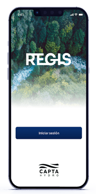
The Capta ReGIS App was developed to digitize the capture of water level and flow information in the field.
With a simple and user-friendly design and interface suitable for all levels of users.
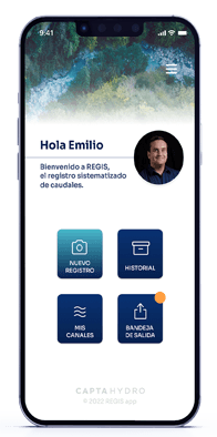
The operator captures photos and enters data directly from the application, avoiding errors. Then, all the information can be visualized and verified in Capta AMARU by administrators.
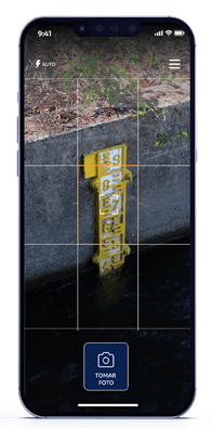
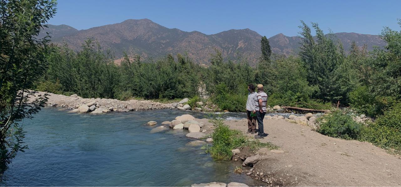
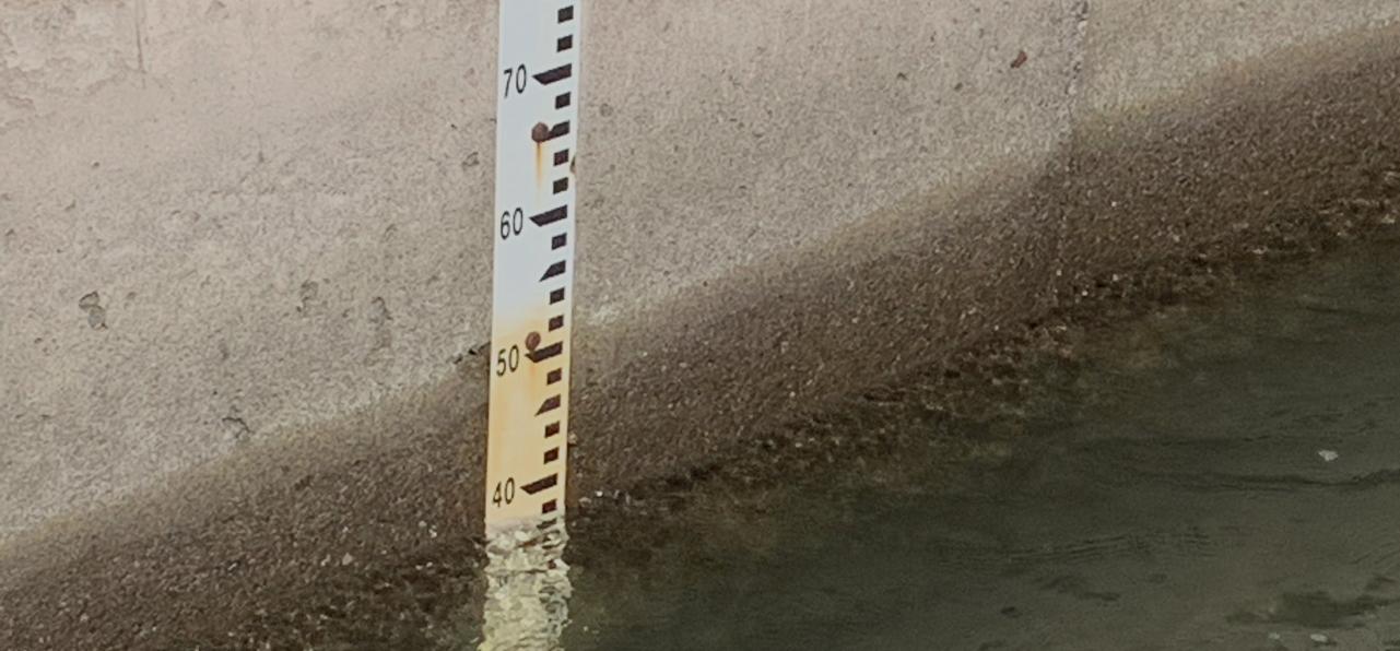
The operator captures images of the measurement section, dam, or meter whose level needs to be checked in their daily tasks.
This image can only be captured from the application, with geolocation and timestamp. Then, the operator records the current level in the application. Compatible with all mobile devices. Easy to use in the field.
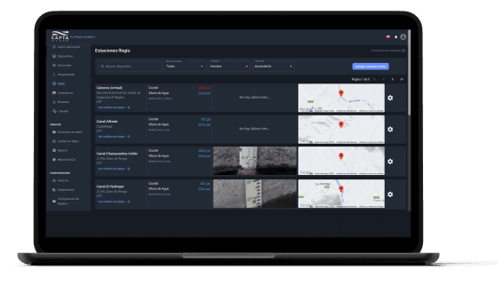
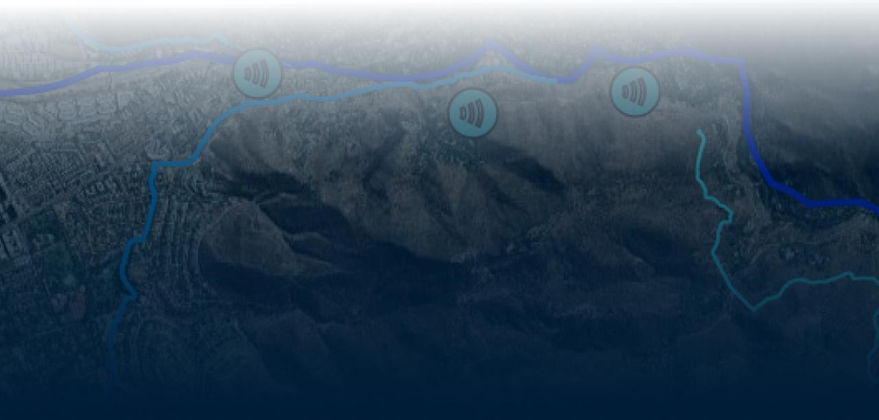
Administrators or directors will be able to visualize all the data captured by their field operators in a single platform, generating a historical record and allowing for immediate analysis of flows and volumes.
Visualization of stations to monitor in the control center.
Visualization of level, flow, and volume graphs.

"The Capta Amaru software allows us to integrate all the basin data in order to have a complete visualization of the water allocations made in the river"
Claudio Bizama, administrator of the JV of the 1st section of the Mapocho River.

Los Ebanistas 8611,
La Reina, Santiago, Chile
+569 9828 0333
contacto@captahydro.com
Mexicali,
Baja California, México
mexico@captahydro.com
Lima, Perú
+51 936 011 920
peru@captahydro.com
California, Estados Unidos
usa@captahydro.com


© 2023 CAPTA HYDRO